ndia, in the cliched observation, is not merely a country but a continent. Its population, which is in excess of one billion and may soon exceed that of China, presents the most extraordinary contrasts. The people of this vast country speak nearly a thousand languages, follow several different faiths — including Hinduism, Christianity, Islam, Buddhism, Jainism, Zoroastrianism, and Sikhism — and are congregated in hundreds of different ethnic and caste communities. But these are only conventional ways of describing the myriad forms of social organization found in India, for the country also has diverse social and ecological movements, women’s organizations, radical political parties, and various interest groups. India is, as is commonly recognized, the world’s largest electoral democracy, and its elections, scattered over a month, represent a triumph of organizational skill and will; at the same time, the country has several dozen communist parties, some of which operate outside formal politics and rely on armed struggle while others are very much part of the traditions of Indian parliamentary democracy. Politics is something of a passion, and perhaps nowhere in the world is democracy so fundamentally a living and contested thing as in India. Unlike in the United States, where political contestation has generally been reduced to choosing between indistinguishable candidates, and in fetishizing an absurd notion of ‘choice’, in India political parties and formations show much more variation, and there is a good deal more of street politics as well. Even the Indian Supreme Court has displayed admirable judicial activism at times.
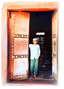 Indian landscapes are just as diverse, from the towering Himalayan peaks in the north to the vast Gangetic plains in north-central India to the coastal regions further south. Cows and vendors on the street, hastily scrawled political slogans and insignia, roadside pan shops and mandirs, small children crammed into cycle rickshaws, and huge bill boards advertising the latest dose of violence and sex doled out by the massive film industry are just as much a part of Indian landscapes. Architectural monuments, cultural traditions, and everyday practices, no less than the chronicles of kings and the exploits of numerous invaders, testify to the complexity of Indian history. To speak of Indian culture is to speak of long (though not necessarily unbroken) traditions of music, art, architecture, dance, sculpture, as well as traditions of film-making; it is also to invoke India’s many cuisines, all reduced in the West to ‘tandoori chicken’, and of course all those signs, gestures, and symbols by means of which people create meaning and communication. Though India is usually associated with religion, being the cradle of half the world’s major faiths, secular and materialist traditions have at least as long and complicated a history as Indian religions.
The social realities of India, notwithstanding the advances of recent years and the attempt to project India as a rising global power, suggest a rather grim picture: working conditions for the greater majority of the people are still exceedingly poor, levels of poverty remain very high, and the oppression of women, the poor, and other marginalized groups constitutes the most formidable obstacle to egalitarian aspirations. This is not the India of the Indians in the diaspora of the North, whose idea of their homeland often rests upon ossified conceptions of Indian religion, tradition, and cultural practices. Yet it is also in the diaspora that new art and cultural forms are emerging, and the relation between India and its diasporic offsprings may yet alter our understanding of Indian civilization.
This site aims at offering a scholarly yet readable narrative of some aspects of Indian history, politics, culture, and religion. It does not in the least aspire to be comprehensive, an objective that at any rate cannot be achieved, and subjects, personalities, and themes have been chosen for exploration and interpretation because they interest the creator of the site, though often they are of intrinsic importance in understanding the history and evolution of Indian civilization.
Web site created by: Vinay Lal
Professor of History, UCLA
We welcome comments to: vinaylal@hotmail.com
Web site designed by: Anju Relan
Associate Professor, Geffen School of Medicine, UCLA
All text on this site is by Vinay Lal, unless otherwise noted.
This page has also been translated into Portuguese by Artur Weber & Adelina Domingos: https://www.homeyou.com/~edu/india-e-seus-vizinhos
This page has also been translated into Slovenian by Valeria Aleksandrova: http://www.pkwteile.de/wissen/indien-och-grannar.
This page is available in a French translation by the team at “Coupon Machine” at http://www.couponmachine.in/socialwork/linde-et-ses-voisins/.
This page is available in a Belarussian translation by Patricia Motosan.
For a Finnish translation of this page by Elsa Jansson, go to: http://mysciencefeel.com/2017/01/31/intia-ja-sen-naapureiden/.
For a Slovak translation of this page by Paula-Maria Niculescu, go to: http://www.bildelarstore.se/science/indie.
For a Thai translation of this page, go to: http://healthcareadministrationdegree.co/socialwork/india/.
For a translation of this page into Russian by Alexander Nikiforov, go to: http://worldartsme.com/blog/archives/368.
For a Ukranian translation of this page by Anna Matesh, go to: http://eustudiesweb.com/india-and-its-neighbors/.
For a Hungarian translation of this page by Elana Pavlet, go to: http://sc-journal.com/india-es-szomszedai/.
For a Macedonian translation of this page by Katerina Nestiv, go to: http://sciencevobe.com/2016/09/29/india-its-neighbours/.
For a Greek translation of this page by Anastasios Manar as, go to: https://directory.net/translate/manas.html.
For an Indonesian translation of this page by ChameleonJohn.com, go to https://www.chameleonjohn.com/translations/southasia-Indonesian.
For a Bosnian translation of this page by Amina Dugalic , go to: http://the-sciences.com/2017/01/04/indija-i-njeni-susjedi/.
For a Punjabi translation of this page by Amaan Singh , go to: https://www.bydiscountcodes.co.uk/translations/india-and-its-neighbors/.
This site accepts neither outside submissions nor any advertisements.
Please do not send any queries about reciprocal links, as MANAS does not
provide any outside links.
All text on this site is copyrighted by Vinay Lal, unless another author is indicated; permission to reproduce should be sent to vinaylal@hotmail.com
Copyright for visuals is indicated where available; please do not send queries for permission to reproduce material unless copyright is with Vinay Lal.
Copyright: Vinay Lal, 1998 – 2017